
Boating on Cayuga Lake - Geography & Weather
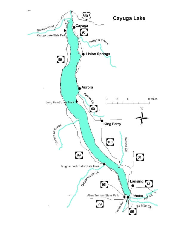
Cayuga Lake Map
Cayuga Lake is long and narrow, with primarily a north-south orientation. It's approximately 38 miles long and the maximum width is 3.5 miles. The maximum depth is 435 feet.
The map below is courtesy of the New York State Department of Environmental Conservation.
Downloadable Chart Booklet
This link below will take you to a downloadable & printable (81/2 by 11) chart booklet for Cayuga and Senaca Lakes. NOAA Chart Booklet
Cayuga Lake Depth Map
You can download a Cayuga Lake depth map from the NYS DEC.
Cayuga Lake Water Temperature & Weather
The north-south orientation and length (fetch) of the lake means waves are most significant with northerly or southerly winds.
Cornell University monitors the winds and temperatures (air & water) near the southern end of the lake and makes 7-day plots available on their website. Note that the temperatures are in degrees Celsius.
Cayuga Lake Area Weather
There are numerous sources of weather forecasts for the region, from National Weather Service to several commercial sources. Some are point specific (i.e., Ithaca, Aurora, Union Springs, Cayuga), whereas others are area discussions. We do not endorse any specific one, nor the advertisements that appear on some of their websites. If you have another source you want to see added to the list, email it to us at: flotilla2.2.ithaca@gmail.com
Point Specific Forecasts for Ithaca:
Note you can obtain the weather for other locations on/near the lakes from these websites as well.
Regional Forecast: Finger Lakes Weather